Subject: Arizona
Period: 1908-11 (dated)
Publication:
Color: Printed Color
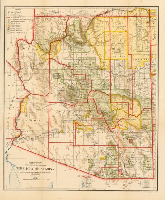
Territory of Arizona, General Land Office, 1908, (16.8 x 20.3"). A colorful map with great detail issued just four years before Arizona attained statehood. The map clearly shows Indian Reservations, Military Reservations (Fort Apache, Fort Grant, Fort Huachuca and Fort Whipple) and Forest Reserves via different colors. A huge Grand Canyon Forest Reserve is shown and the new Petrified Forest National Monument (established in 1906) is located east of Holbrook. Details include watershed, mountains, railroads, wagon roads, private claims, unsurveyed townships, etc. Still a fine example with just one spot in lower margin. (A+)
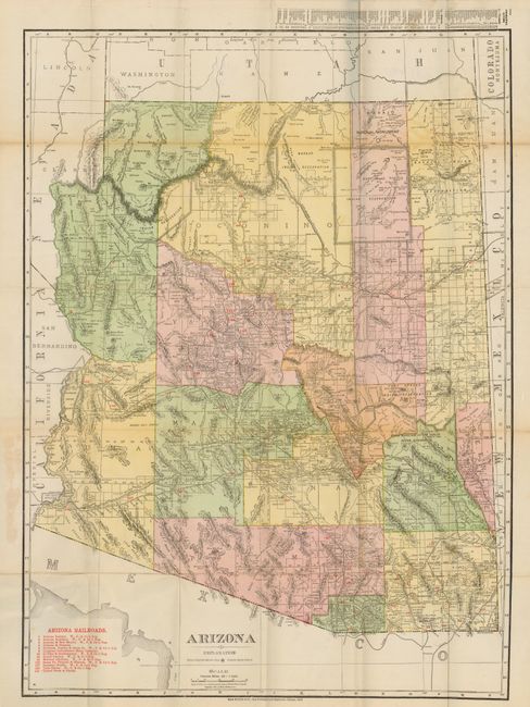
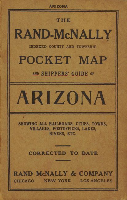
The Rand McNally Indexed County and Township Pocket Map and Shippers' Guide of Arizona, Rand McNally, 1911, (4.2 x 6.5"). Map of Arizona (18.8 x 28.8" ). Large and highly detailed map of the territory that was published the year before statehood. The red overprinted table at lower left keys 13 railroads to the map including the Santa Fe, Twin Buttes, Grand Canyon, and the Atchison, Topeka & Santa Fe. Index to Principle Cities at upper right outside the neatline. Blank verso. Folds into paper covers with 30 page index to cities. Also in the booklet are 12 pages of great advertisements: Fred Harvey, Hotels operated by the Santa Fe Railroad, Copper Queen Hotel in Bisbee, in San Francisco the Golden West Hotel and Hotel St. Francis, and several more. Very nice example with very clean covers. One small area of light toning on one fold, still fine. (A+)
References:
Condition: A+
See individual descriptions.