Subject: Mid-Atlantic
Period: 1862-4 (dated)
Publication:
Color: Black & White
The Office of Coast Survey is the oldest U.S. scientific organization, dating from 1807 when Congress directed that a "survey of the coast" be carried out. By 1836, it was called the U.S. Coast Survey and in 1878, the name was changed to the U.S. Coast and Geodetic Survey. Today the Office of Coast Survey is a division of the National Oceanic and Atmospheric Administration NOAA.
The survey teams, composed of civilians as well as Army and Naval officers, charted the nation's waterways and produced a wide array of reports, survey charts, hydrographic studies of tides and currents, astronomical studies and observations, and coastal pilots. These charts are an important record of the changing nature of the nation's coastlines. In additional to coastal charts, the U.S. Coast and Geodetic Survey produced land sketches, Civil War battle maps, and the early aeronautical charts.
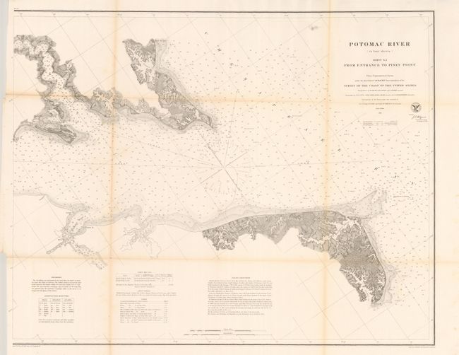
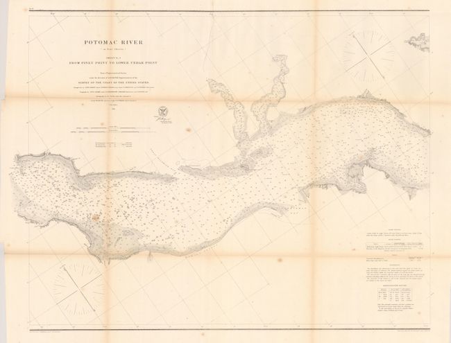
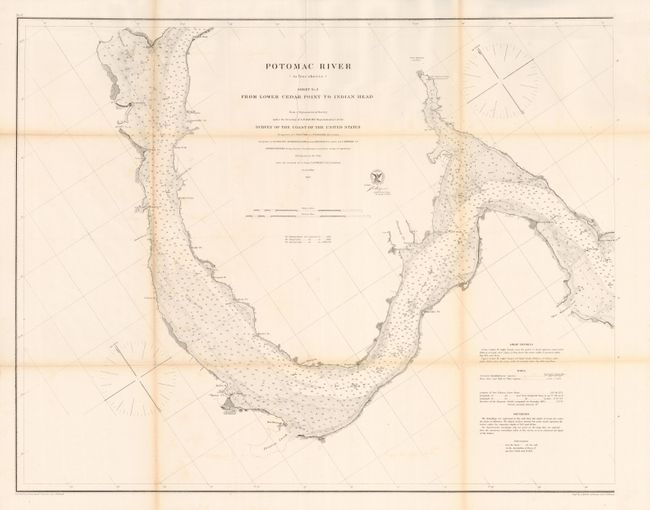
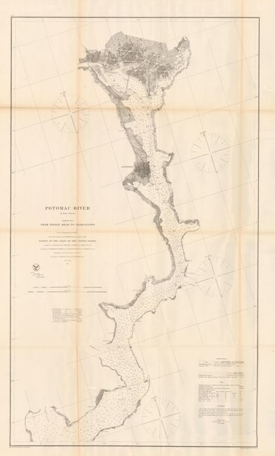
Full set of maps that chart of the Potomac River from Washington, D.C. to its entrance into the Chesapeake Bay. The charts indicate soundings, tides, lighthouses, and the shoreline configuration.
Sheet No. 1 From Entrance to Piney Point, (29.3 x 23.2").
Sheet No. 2 From Piney Point to Lower Cedar Point, (30 x 23").
Sheet No. 3 From Lower Cedar Point to Indian Head, (29.3 x 23").
Sheet No. 4 From Indian Head to Georgetown, (22.5 x 39.2").
References:
Condition: B+
Folding as issued with mild fold toning and a couple tiny fold intersection splits. Sheet No. 1 has an insertion tear entering 2" in to the map, closed on verso with archival tape.