Subject: San Francisco, California
Period: 1853 (dated)
Publication:
Color: Black & White
Size:
17.8 x 26 inches
45.2 x 66 cm
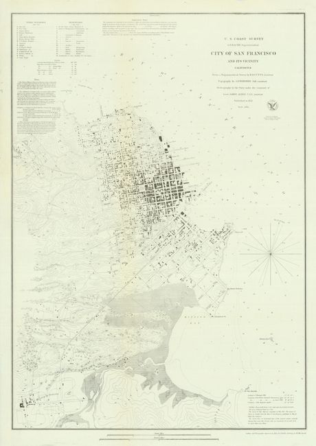
This early plan of the city of San Francisco covers the region from North Point to Mission de Delores and to Point San Quentin. The city plan was derived from a number of sources, including Eddy's official map of the city and the now rare map by Cooke and Le Count, with topography by A.F. Rodgers. The streets are clearly laid out and named with detail down to individual buildings and contour lines at 20 ft. intervals showing elevation. Buildings are shown in black along the streets in both San Francisco and Mission de Dolores, and a Plank Road connects the two communities. A key indicates sixteen public buildings and fifteen reservoirs and numerous notes describe the soundings and navigational hazards.
References:
Condition: A
Issued folding, now flattened. Delicate impression on thin banknote-style paper.