Subject: Atlases
Period: 1857 (published)
Publication:
Color: Printed Color
Size:
10 x 15 inches
25.4 x 38.1 cm
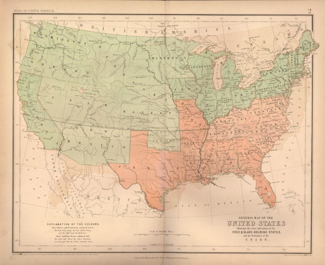
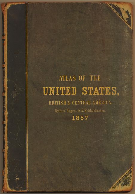
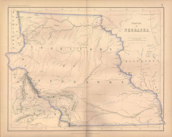
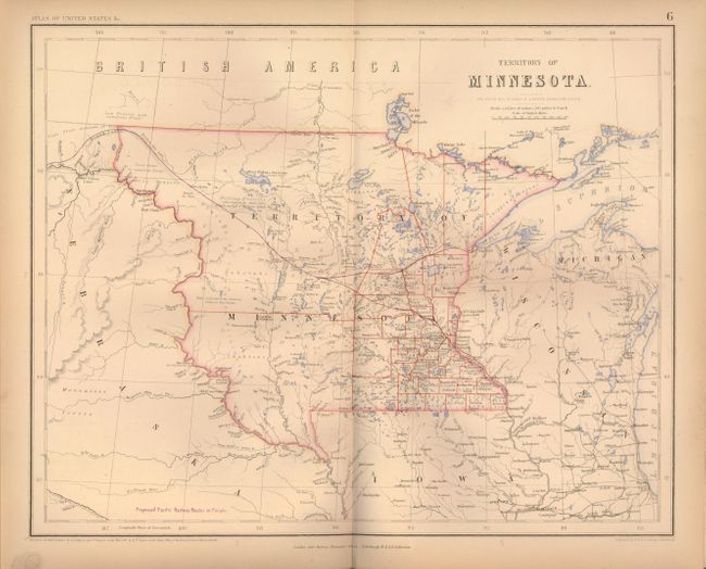
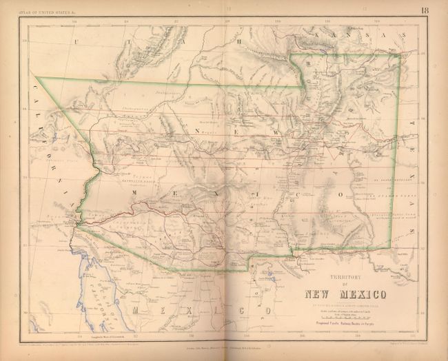
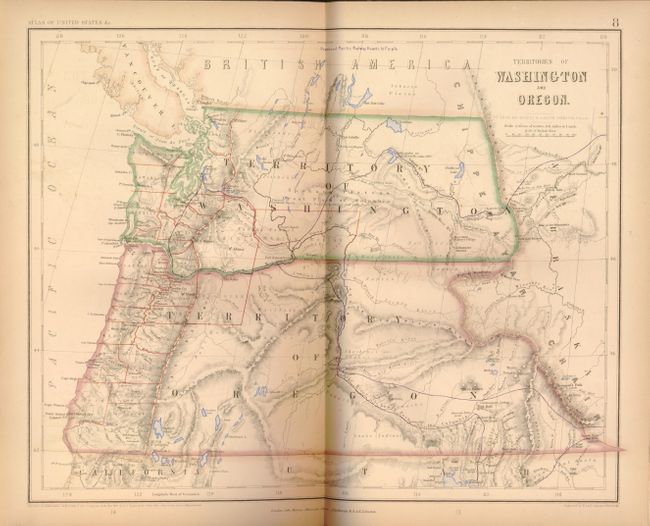
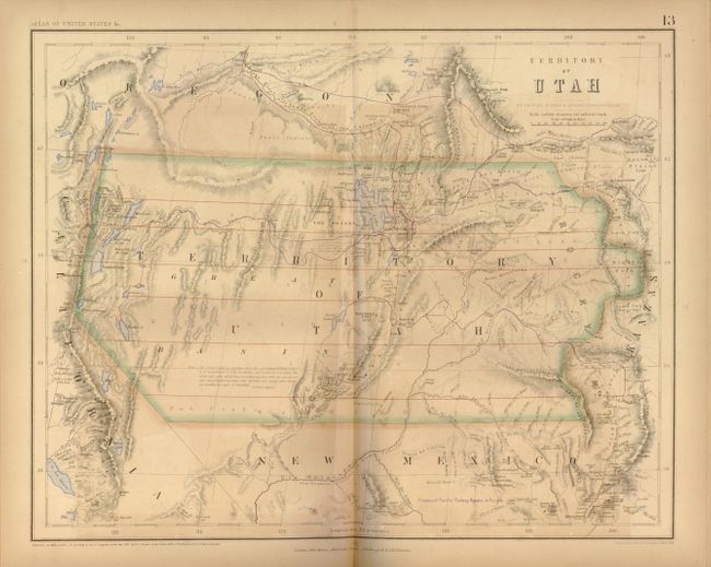
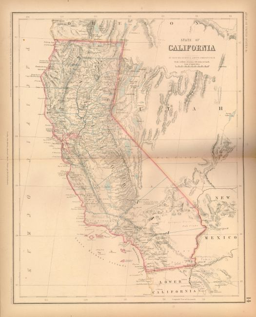
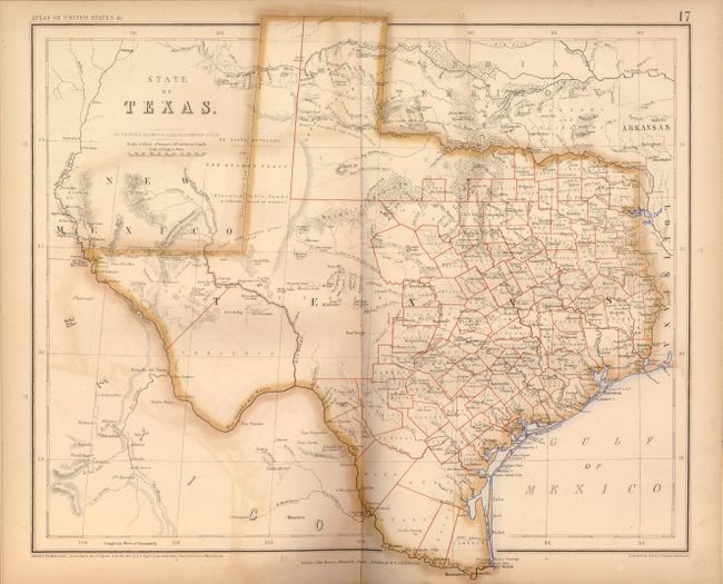
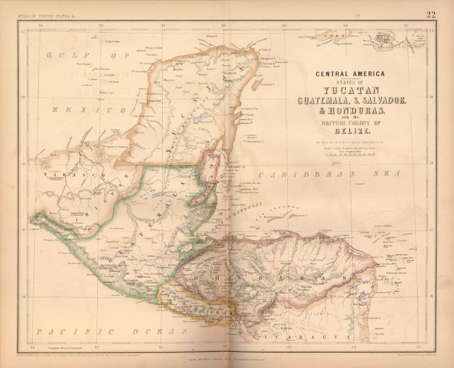
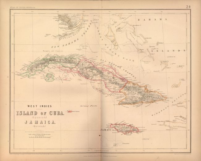
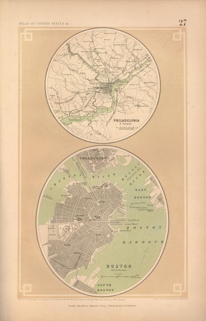
This important and rare atlas was a collaboration between the British cartographer Alexander Keith Johnston and the American geographer Henry Darwin Rogers. Their combined efforts produced one of the finest groups of U.S. maps in the 19th century, most notably the outstanding maps of the western States and Territories. There are 23 expertly rendered double-page maps, each with a crisp engraving and a combination of hand and lithograph coloring, plus the Index map. In the back of this terrific atlas are nine city plans printed on five sheets, Plates 25 - 29. The General Map of the United States delineates "Free and Slave Holding States", and has a key explaining which states exported, and which imported slaves. The Territory of Nebraska is particularly eye-catching as it is tremendously detailed and encompasses the Dakotas, Montana and Wyoming. Other important maps in this atlas include the Territory of Minnesota that shows early county configurations, Territory of New Mexico with details including mines, Indian villages and ruins, and Territories of Washington and Oregon with numerous forts, Indian tribes and early development west of the Cascades. The Territory of Utah has a long note in the map, credited to Fremont's Report, discussing the Great Basin's elevation, topography and its numerous land-locked rivers and lakes. The inhabitants here are described as "savage tribes which no traveller has seen or described." This is certainly one of the rarest of all maps of the Utah Territory. The proposed route of the Pacific Railway is shown in purple and winds its way across the maps of the western U.S. Several of these maps appear in no other atlas, making this an exceptionally desirable example. Small folio, complete. Hardbound in green cloth with quarter calf, embossed gilt titling with gilt to all edges of maps (TEG).
References: Phillips (A) 3670; Wheat [TMW], Vol. IV, p.66.
Condition: B+
Maps are generally very nice and vary from B+ to Very Good. Binding is rubbed and bumped with front and rear edges of spine worn, as are tips. Contents tight. Pencil inscription on front pastedown, child's pencil sketch on first free end paper and ink inscription "M.A. Hayward in remembrance of Henry Darwin Rogers LLC." We can find no relationship to Hayward and Rogers so this inscription remains a mystery.