Subject: North Pacific Ocean
Period: 1785-88 (circa)
Publication: Raynal's Atlas de toutes les parties connues du Globe Terrestre…
Color: Black & White
Size:
13.5 x 9.2 inches
34.3 x 23.4 cm
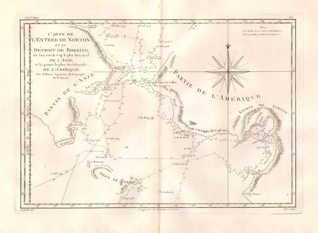
1)Carte de l'Entree de Norton et du Detroit de Bhering, ou l'on voit le Cap le Plus Oriental de l'Asie et la pointe la Plus Occidentale de l'Amerique. Great map of the Bering Strait showing the Chukotskiy and Seward peninsulas and parts of St. Lawrence Island (here Isles de Clerke). It plots the course of the voyages of 1778 and 1779, with soundings along the track. Cook had already died when the third expedition reached this area and the expedition was led by Captain Charles Clerke. Engraved by Andre and decorated with a large compass rose.
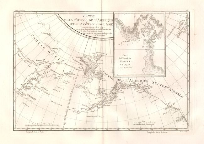
2) Carte de la Cote N.O. de l' Amerique et de la Cote N.E. de l'Asie, Reconnues en 1778 et 1779. This chart is centered on the Bering Strait with soundings and dates that chart Cook's third voyage up the northern reach of the Pacific in his search for a Northwest Passage. Cook probed along the Oregon coast in bad weather to Nootka Sound, where he rested and refitted his ships. They sailed forth to the Alaskan and Chukotskiy peninsulas and from there into the Bering Strait. Cook reached 70° 41’ N before being forced back by the pack ice off Icy Cape. The expedition turned south down the Russian coast and then east to Norton Sound. Cook's journey then ended in Hawaii where Cook was killed on February 14, 1779 in a dispute with the natives.
References:
Condition: A
Both on thick hand laid paper, one with a lion watermark. With deckled edges on all sides, soiled along top edge.