Subject: Middle East
Period: 1851-57 (published)
Publication: Illustrated Atlas and Modern History of the World
Color: Hand Color
The maps from The Illustrated Atlas were first published in serial form to a target audience that led insular lives due to the expense and hardship of travel. All that changed as the progress of the nineteenth century brought swift and dramatic changes in public awareness of far away places. Tallis' maps no doubt played an important role in this dramatic awakening. These maps not only provided up-to-date geographical knowledge, but also used vignette views within the map's design to show the native people and their occupations, cities and points of interest. The maps hark back to a cartographic tradition from the Dutch mapmakers of the seventeenth century with finely engraved decorative borders. The maps were drawn and engraved by John Rapkin with views drawn and engraved by a number of prominent artists. The maps were issued as a complete volume from 1851 until about 1865. Some of the maps were also published in other history books published by Tallis including British Colonies and, without the vignettes, in geographical dictionaries and encyclopedias until about 1880.
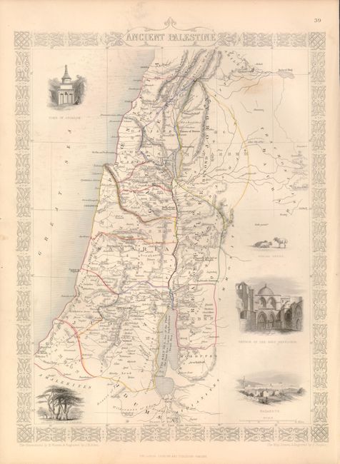
1. Ancient Palestine, (1851, 9.5 x 13"). Fine steel engraved map covering the region of Israel, Lebanon and part of Jordan. Decorated with vignettes of tomb of Absalom, Church of the Holy Sepulchre, Nazareth, Ancient Cedars of Lebanon and Syrian Sheep enclosed in a delicately engraved border. Map drawn and engraved by John Rapkin, vignettes drawn by H. Warren and engraved by J. B. Allen. One diffuse foxing area in upper right. (B+)
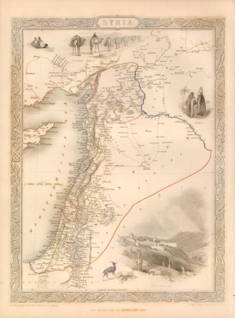
2. Syria, 1851, (9.5 x 13"). Beautiful steel engraved map with Tallis' lovely vignettes and scroll borders. The Syrian map includes all of present day Syria, Lebanon, and Israel, with a bit of Turkey and Cyprus. Vignettes include Jerusalem, a camel caravan and Arab people. The map was drawn and engraved by J. Rapkin with H. Warren & J. Rogers engraving the borders and vignettes. With sheet of text. With some very light foxing or toning. (B+)
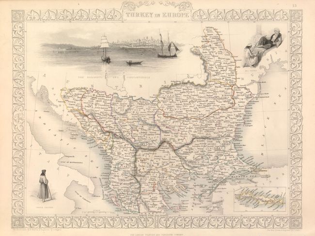
3. Turkey in Europe, 1851, (13 x 10"). Small inset of Candia. Fine vignettes include a large view of The Bosphorous and Constantinople with sailing boats in foreground, and two scenes of native peoples. Decorative border. Map drawn and engraved by John Rapkin, vignettes drawn by H. Warren and engraved by J. Rogers. With sheet of text. Near flawless. (A)
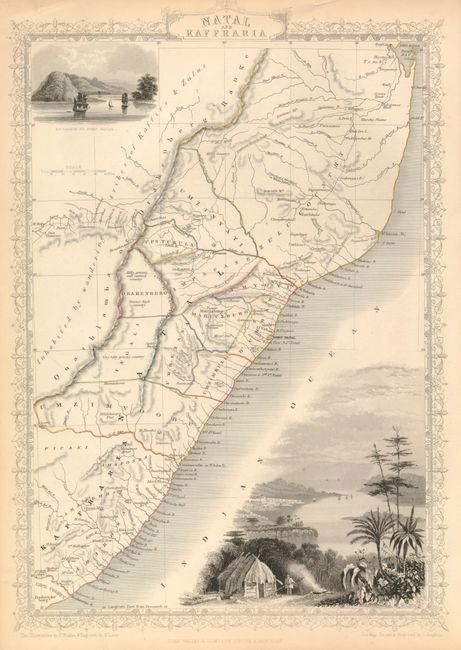
4. Natal and Kaffraria, 1857, (9.5 x 13.7"). Covers the region from Fredericksburg to Delagoa Bay. Finely engraved border and large vignettes of Port Natal and Town of Durban, and the Entrance to Port Natal. A nice example with uncolored vignettes and borders, as issued. Map drawn and engraved by John Rapkin, vignettes drawn by H. Winkles and engraved by W. Lacey. With sheet of text. Good margins with a little toning at edges and fold with crease in top margin. (B+)
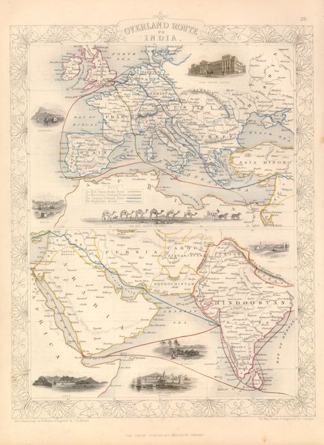
5. Overland Route to India, (9.6 x 13"). Two maps showing routes from Europe to India over and by sea. The top map showing Europe includes vignettes of Post Office in London, Gibraltar, Malta and the Mail Crossing the Desert by way of camel caravan. Arabia and India are shown at the bottom with vignettes of Suez, Aden, Bombay and Madras. An ornate outline border surrounds the two maps. Maps drawn and engraved by John Rapkin, vignettes drawn by H. Warren and engraved by J.H. Kernot. With sheet of text. Map image is flawless, some light toning in margin edges. (A)
References: Map #1 - Manasek #111.
Condition:
See individual descriptions. All with original hand color.