Subject: South Pole
Period: 1763 (dated)
Publication: Gentleman's Magazine
Color: Black & White
Size:
8.8 x 7.7 inches
22.4 x 19.6 cm
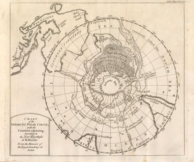
This circular polar projection includes part of southern South America, South Africa and all of Australia (with Tasmania and New Guinea shown attached to the mainland). The large Antarctic continent has a connected New Zealand which is depicted as a single land mass rather than two islands. Within the continent is a huge reservoir as well as many interesting place names including Land yet Undiscovered, Disgorgement of the Ice, Iceland, Traces of a supposed Chain of Mountains, to mention a few. The map provides a fascinating glimpse into Buache's imaginative cartographic theories, and also notes the coastline according to the mapping of Ortelius. Many notations including: "C. of the Terra Australis according to Delisle" and several comments regarding ice being seen by various explorers such as "Ice seen by M. Bouvet in 1738."
References: Jolly GENT-166.
Condition: B+
Two small spots at lower middle near neatline and a little light soiling in upper left quadrant, otherwise very good.