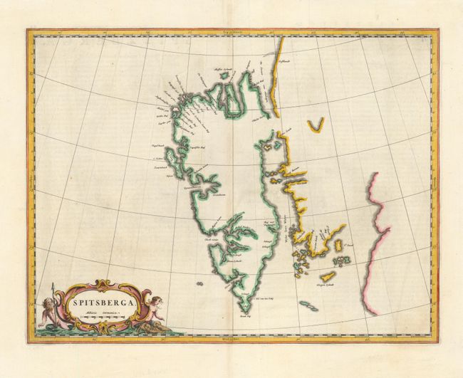
Subject: Spitsbergen, Norway
Period: 1662 (circa)
Publication: Atlas Major
Color: Hand Color
Size:
19.5 x 15 inches
49.5 x 38.1 cm
Blaeu's map of Spitsbergen stands alone among Dutch charts. It is based was the Muscovy Company's map of 1625, but the north coast is completely new. It makes the heads of Wiche sound (Liefde bay) and Wyde bay communicate, and it marks and names Hinlopen strait. It also introduced a number of place names. Spitsbergen was an important station for Dutch whalers in the 17th centuries. This is an uncommon example without the ships and whaling scene. The map was created for the Atlas Major and the copperplate was destroyed in the 1672 fire that destroyed the Blaeu printing house; thus is it quite rare.
References:
Condition: B+
Faint toning along the centerfold, else very good.