Subject: Wales
Period: 1744 (circa)
Publication: Great Britain's Coasting Pilot
Color: Hand Color
Size:
22 x 17.3 inches
55.9 x 43.9 cm
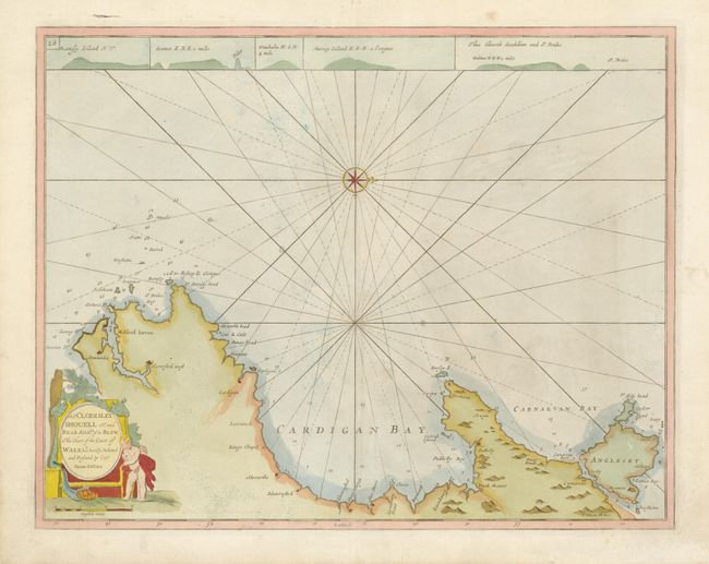
In 1679 Greenvile Collins was appointed Hydrographer to the King by Charles II. In 1681 he was appointed by the Admiralty to make a complete survey of the coasts of Great Britain. Prior to this date the charts used by English mariners were copies of Dutch charts that had many inaccuracies and the work of John Seller that was limited in scope. The task of surveying the entire coast was formidable and took nearly a decade. The Coasting Pilot, containing 48 charts, was first published in 1693 with editions continuing until 1792. This chart covers the coast of Cardigan and Carnarvan bays from Milford haven to Holy head. Prospect views show coastlines across the top of the chart. A cartouche at lower left contains the dedication to Sir Cloudesley Shovell. A ghost of the old scale is visible to the right of the distance scale indicating this example was published after 1744.
References: Verner (MCC-58) #15.
Condition: A
There is a hint of minor toning and a bit of soil in the blank margins.