Subject: Wales
Period: 1675 (circa)
Publication: Britannia
Color: Hand Color
Size:
16.8 x 12.5 inches
42.7 x 31.8 cm
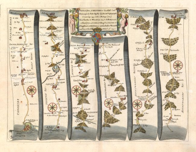
John Ogilby's 'Britannia' was published between 1675 and 1698. It is a landmark in the mapping of England and Wales. Its unique format constituted the first national road-atlas of any country in Western Europe. It was composed of maps of seventy-three major roads and cross-roads, presented in a continuous strip-form, on a uniform scale of one inch to a mile. Each beautiful map includes wonderful detail of the countryside with each strip containing a large compass rose to indicate changes in direction.
The road begins at West Chester and proceeds south through Wrexham, Llanfylin, and Newton and ends at Vunneth-Llanbader. Each of the six panels has a decorative compass rose to orient the traveler. Title cartouche in a strapwork and garland style flanked by putti with the royal coat of arms below.
References:
Condition: A
Very nice example with good impression and color on a sheet with wide, original margins.