Catalog Archive
Auction 133, Lot 399

"The Continuation of the Road from London to St. Davids Comencing at Monmouth & Extending to Burton Ferry", Ogilby, John
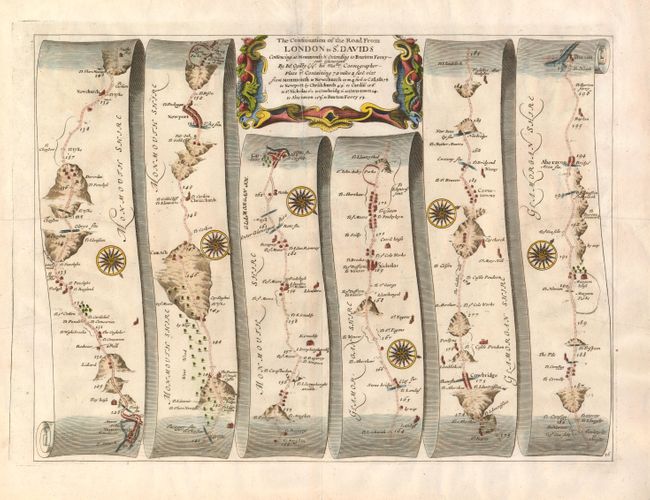
Subject: Wales

Period: 1675 (circa)

Publication: Britannia

Color: Hand Color

Size:
17.5 x 12.8 inches
44.5 x 32.5 cm
Download High Resolution Image
(or just click on image to launch the Zoom viewer)

John Ogilby's 'Britannia' was published between 1675 and 1698. It is a landmark in the mapping of England and Wales. Its unique format constituted the first national road-atlas of any country in Western Europe. It was composed of maps of seventy-three major roads and cross-roads, presented in a continuous strip-form, on a uniform scale of one inch to a mile. Each beautiful map includes wonderful detail of the countryside with each strip containing a large compass rose to indicate changes in direction.

This map covers sixty-nine miles of road through southern Wales. It passes through several small villages and the towns of Newport and Cardiff.

References:

Condition: B+

There are a couple of printer's creases, else very good.

Estimate: $300 - $375

Sold for: $200

Closed on 9/1/2010

Archived