Subject: World - Polar
Period: 1679 (dated)
Publication:
Color: Hand Color
Size:
21 x 15.2 inches
53.3 x 38.6 cm
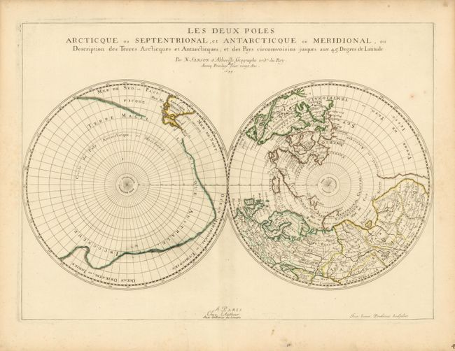
The extent of polar explorations is the focus of this unusual map of the north and south poles. In the Northern Hemisphere, Greenland is depicted attached to the American continent, and three large islands comprise the Canadian Arctic. It is hinted that Terre de Yezo, ou Iesso takes up the entire North Pacific region between Buttons Bay and East Asia. In the Southern Hemisphere, the tip of South America is shown with the Strait of Magellan and Le Maire Strait. The balance of the map is filled with a large landmass labeled Terre Magellanicque, Australe, et Incogneue. Engraved by Jean Somer Pruthenus.
References: Kershaw #145.
Condition: A
Nice impression and original outline color. There are a couple tiny spots, still overall very good.