Catalog Archive
Auction 133, Lot 363

"A New General Chart of the Atlantic or Western Ocean with Adjacent Seas Including the Coasts of Europe and Africa from 60 Degrees North Latitude to the Equator and Also the Opposite Coast of North America…", Laurie & Whittle

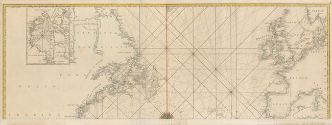
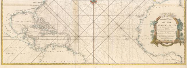
Subject: Atlantic Ocean

Period: 1794 (dated)

Publication:

Color: Hand Color

Size:
54.7 x 38.6 inches
138.9 x 98 cm
Download High Resolution Image
(or just click on image to launch the Zoom viewer)

This huge large-scale map of the North Atlantic includes superb detail of the coastlines of the Americas, Europe and northern Africa. The chart is centered on a 32-point compass rose from which rhumb lines are arrays across the chart. There is a large inset of Hudson Bay. The ornamental cartouche is decorated with trees, shells and banners & topped with clouds & wind heads. In the late 18th & early 19th century the partnership of Robert Laurie & James Whittle produced some of the finest sea charts available at that time. The chart is comprised of four sheets with two pairs joined (19.2 x 54.7"), which if joined form the complete chart with the measurement as given.

References:

Condition: B

There are some old tape stains from a previous joining and some archival tape repairs of fold separations on verso. The two sheets are slightly different paper tones.

Estimate: $1,400 - $1,600

Unsold

Closed on 9/1/2010

Archived