Subject: Atlantic Ocean
Period: 1740 (dated)
Publication: Gentleman's Magazine
Color: Black & White
Size:
11.7 x 13.8 inches
29.7 x 35.1 cm
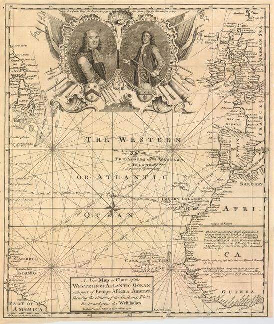
This handsome map of the Atlantic illustrates the commercial rivalry between Britain and Spain with the major shipping routes traced. It includes small parts of South America, the Caribee Islands, Newfoundland and Labrador, western Africa and Europe. The chart is covered with interesting notations concerning the history of the region, territorial claims, and the tracks of the Spanish treasure fleets. A large military-style cartouche features the portraits of Admiral Blake (1650) and Vice Admiral Vernon (1740); two immensely popular British admirals in the ongoing fight against Spain. This map was published at the beginning of the War of Jenkin's Ear in which Vice Admiral Vernon captured the Spanish possession of Porto Bello. Ironically, less than a year later his next campaign against the Spanish at Cartagena ended in disaster, virtually ending his illustrious naval career.
References: Jolly GENT-14.
Condition: C+
Issued folded, now flattened with a binding tear entering the title cartouche at bottom - the tear has both old paper and cello tape on verso. A couple of the folds have short splits entering the map at left. The map is very presentable but would greatly benefit from simple conservation.