Subject: Lesser Antilles
Period: 1758 (circa)
Publication: Prevost's Histoire Generale des Voyages
Color: Hand Color
Size:
11.8 x 7.8 inches
30 x 19.8 cm
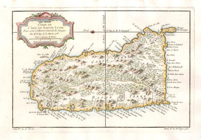
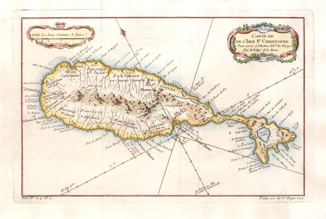
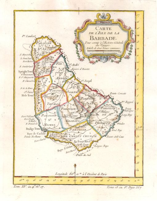
These small maps of islands in the Lesser Antilles are finely engraved to show the mountains, forests, rivers, roads, towns and particularly the minute coastal detail for which Bellin is renowned. Each is nicely decorated with a rococo-style cartouche.
1) Carte de l'Isle de Sainte Lucie The island of St. Lucia is divided into the region controlled by the native Caribs and the colonial sugar plantations. A fleur-de-lis orients the map with north to the left. (11.8 x 7.8")
2) Carte de l'Isle St. Christophe The island of St. Kitts has 12 quarters and parishes along the productive coastlines. The center of the island is dominated by a mountainous ridge where Mont Misery and the Mines de Souffre are located. (12 x 7.5")
3) Carte de l'Isle de la Barbade (5.8 x 7.8") The island of Barbados is divided into eleven parishes with a well developed network of roads throughout the island.
References:
Condition: A
There are some minor stains in the blank margins.