Catalog Archive
Auction 133, Lot 29

"Neue Welt-Karte Welche auf Zwoo Kugelflaechen die Haupt-Theile der Erde…", Homann Heirs
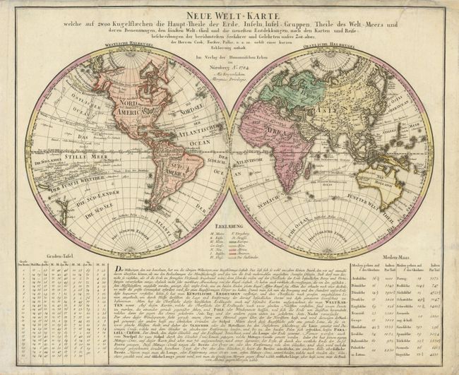
Subject: World

Period: 1784 (dated)

Publication:

Color: Hand Color

Size:
22 x 18.6 inches
55.9 x 47.2 cm
Download High Resolution Image
(or just click on image to launch the Zoom viewer)

This interesting world map presents some curious cartography, given the date of the map. The Great Lakes are shown as one huge body of water and California is strangely shaped with the Baja nearly appearing as an island. Australia includes several place names on the eastern coast, which resulted from Cook's discoveries in 1770. However, Van Diemens Land is still shown connected to the mainland. The tracks of several late 18th century expeditions are shown. Original color, with color key. German text panel below the hemispheres.

References:

Condition: B

There is surface soil and several short repaired tears.

Estimate: $900 - $1,100

Sold for: $650

Closed on 9/1/2010

Archived