Subject: South America
Period: 1840 (circa)
Publication: A New General Atlas
Color: Hand Color
Size:
30 x 21.2 inches
76.2 x 53.8 cm
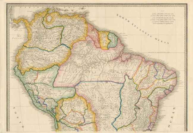
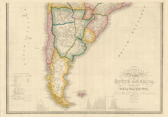
This striking large map is drawn from Louis Stanislas D'Arcy Delarochette's monumental eight sheet map of South America, which was used to settle numerous border disputes throughout the continent. It incorporates the most up-to-date geographical information and includes numerous interesting notations throughout.
Three insets in the lower portion of the map present data from Humboldt's report in the form of topographical profiles: "Section of the Andes…," "Section of South America from West to East…," and "Section of the Road from La Guayra to Caracas." Also included is a comparative distance table and an index titled "Civil Divisions, Population and Extent" for Colombia, Peru, the United Provinces, Chili, Patagonia, Brazil and Guyana. Printed on two sheets, unjoined, as issued - the map would measure 30 x 42.5" if joined..
References:
Condition: A
Superb original color with a few minor edge tears.