Subject: Gulf of Mexico and Caribbean
Period: 1747-66
Publication:
Color:
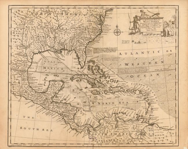
1) An Accurate Map of the West Indies. Drawn from the Best Authorities… , by Emanuel Bowen, circa 1747, uncolored (16.5 x 13.5). This handsome map covers the southeastern United States, eastern Mexico, Central America, the West Indies, and the northern part of South America. It is derived from Popple's important map of the region. The British colonies in North America are confined east of the Appalachians with France in control of Louisiana. Many early forts and Indian tribal territories are located. There are several interesting notations concerning the history of the region, such as a notation concerning the southern boundary of the Province of Carolina, "so that Fort St. Augustin as well as Georgia falls within these limits." Trade winds and sea routes are marked throughout, including the course of the Spanish gold fleet from Old Spain and the return trip from Cartagena and Vera Cruz. The title cartouche is adorned with Native Americans and an incongruous lion (likely representing the British colonies). Ref: Sellers & Van Ee #1682. Nice impression and pleasantly ivory toned paper with some minor soil and a small damp stain on the lower centerfold. The map has been professionally backed with light Japanese tissue, restoring some chipping in the blank margins and reinforcing the centerfold.
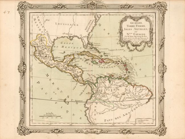
2) Guayane, Terre Ferme, Isles Antilles, et Nlle. Espagne, by Brion de la Tour, in Desnos' Atlas General, civil, ecclesiastique et militaire, 1766, original hand color (12 x 10.8"). This unusual map focuses on Mexico, Central America, northern South America and all of the islands of the West Indies. There is no topographical detail shown in North America or below the Amazon River. The coloring illustrates the various colonial possessions and symbols locate missions throughout the region. The map is embellished with a rococo-style cartouche and highly decorative borders that were printed from a separate copperplate. There is a bit of light soil in the map.
References:
Condition: B+