Subject: Northeastern United States
Period: 1832 (dated)
Publication: The History and Topography of the United States
Color: Black & White
All three are very finely engraved and give the appearance of steel engravings. Each with fancy titling and flourishes.
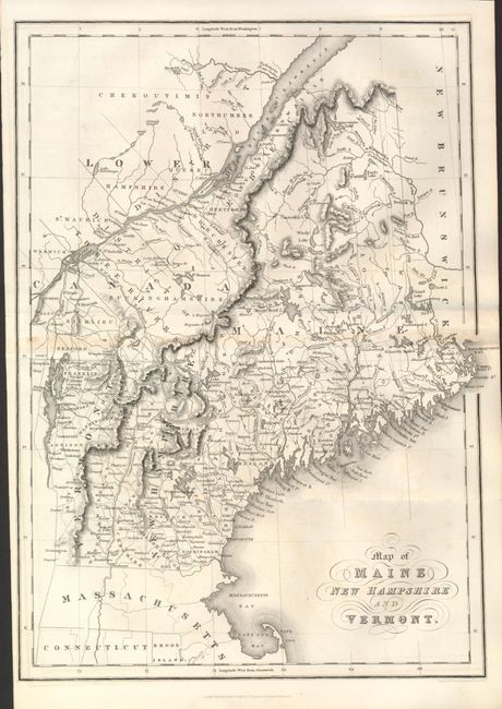
1) Map of Maine, New Hampshire and Vermont, 1832, (10.4 x 14.2"). Very faint centerfold toning. (B+)
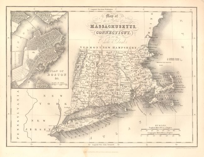
2)Map of the States of Massachusetts, Connecticut, and Rhode Island, 1832, (9.8 x 7.3"). Includes a large and finely engraved inset plan of Boston with excellent detail of mountains, rivers, roads, lakes, towns, and a host of other information. Mint less a tiny, light stain in lower margin. (A)
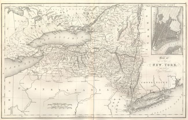
3)Map of the State of New York, with part of Upper Canada, (15.6 x 9.7"). The inset plan at upper right details Manhattan with all streets delineated but not named. ((A)
References:
Condition:
See individual descriptions.