Subject: Western Hemisphere
Period: 1722 (dated)
Publication:
Color: Hand Color
Size:
24 x 19.2 inches
61 x 48.8 cm
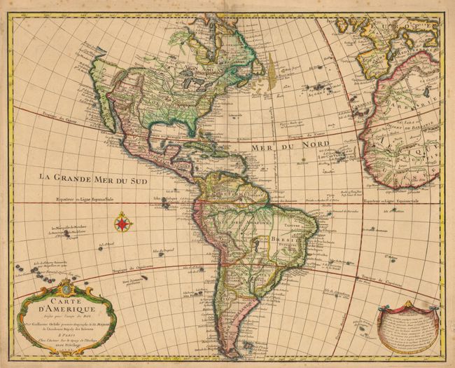
This is an early edition of one of the most popular maps of the 18th century. The detailed map of the Americas provides a great deal of information about the state of geographic knowledge in the New World in the early part of the century. In North America the western coast is blank above California. The French territory of Louisiane takes up the lion's share of North America at the expense of the British colonies. This political bias is due to Delisle's position as geographer to the King of France. South America is much better represented with good depiction of the river systems and locations of the Jesuit missions.
References: Tooley (Amer) p. 13, #2.
Condition: B+
Dark, early impression with pleasant overall toning and some scattered foxing mostly in the upper blank margin. There is some paper framer's tape residue on the verso.