Catalog Archive
Auction 131, Lot 930

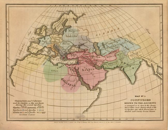
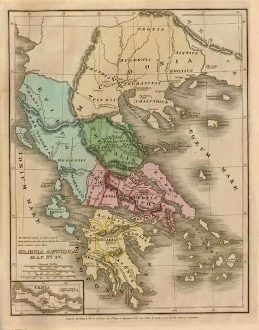
"[Lot of 2] A New and Improved School Atlas, to Accompany the Practical System of Modern Geography [and] Ancient Atlas, to Accompany the Universal Geography",

Subject: School Atlases

Period: 1829-1830 (dated)

Publication:

Color:

Size:
See Description
Download High Resolution Image
(or just click on image to launch the Zoom viewer)

The United States and Great Britain established in 1818 joint claim over the Oregon Territory - the region north of Spanish controlled Upper California up to the southern boundary of Russia's Alaska Territory at North latitude 54°40'. By the late 1830's this arrangement was beginning to fall apart. In the 1840's the expansionist Democrats, including their 1844 presidential candidate, James Polk, claimed the entire region for the United States. Their expansionist desires were expressed by Polk's famous campaign slogan, "Fifty-four Forty or Fight!" The slogan also became a rally cry for Americans desiring to settle the territory. Following Polk's election, the dispute was resolved by the 1846 Treaty of Oregon, which struck a compromise that fixed the U.S./Canadian boundary at 49º North.

The first atlas is by J. Olney, published by Robinson Pratt & Co., circa 1830, 9.5" x 11.5". This is a complete example of Olneys' atlas with eleven well engraved and hand colored maps. It is an early edition that includes: world in hemispheres (dp), world with thematic chart of religions, North America, United States, Eastern States, Middle States and part of Southern States, Ohio and Indiana, South America, Europe, Asia, and Africa. The cartography in the United States shows North West Territory between Lake Michigan and the large Missouri Territory which extends from the Missouri River to Oregon Territory and south to the oversized Arkansas that includes part of today's Oklahoma. On the North American and United States maps the boundary in the Northwest extends well into British America per the "Boundary determined in 1824." The Great Salt Lake is not shown but a large Lake Timpanogos is roughly in its place. The twelfth sheet is a thematic chart that shows the comparative size, population and forms of government around the world with four engraved vignettes; Indian Village, Morocco, Constantinople and New York. Printed paper covers that double as the title page and list of maps. Published by D.F. Robinson & Co. The maps are generally very good. Covers are held together at the spine with archival tape, first map is loose. Complete (B).

The second atlas is a rare example by Emma Willard "Principal of the Female Seminary at Troy" and may be the first school atlas produced by a woman. It was published by Oliver D. Cooke & Co., 1830, 9.5" x 12". The hand colored maps includes two Ancient Worlds; "Italy, Greece, Asia Minor and Syria with the Ancient and Modern names of places;" ancient Greece, "Mesopotamia, Assyria, Babylonia and Chaldea; with a map of Palestine" and the "Migrations, Settlements, &c. of Barbarous Tribes." This famous school, originally known as the Troy Female Seminary, is today the important Emma Willard School. Read about this remarkable woman, her pioneering efforts and the history of her school here. Printed paper covers, hand colored maps, and list of questions for the teacher in inside covers. Maps with strong impression and lovely full original hand coloring. Some light offsetting to maps, covers are toned and soiled with some chipping at edges. Complete (B+).

References:

Condition:

See individual descriptions.

Estimate: $300 - $350

Sold for: $200

Closed on 3/17/2010

Archived