Subject: Western Hemisphere
Period: 1632 (published)
Publication: Atlas sive Cosmographicae
Color: Black & White
Size:
9.8 x 7.6 inches
24.9 x 19.3 cm
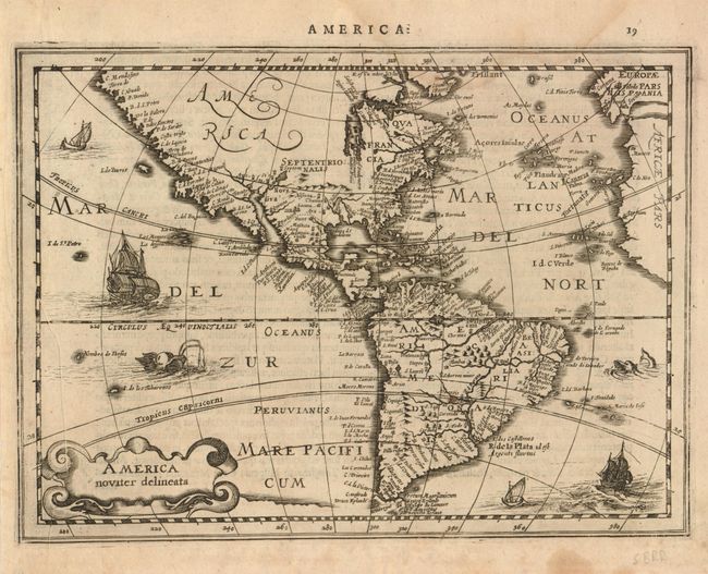
First state of this very uncommon map from the reduced size series of the Mercator-Hondius atlas. The cartography is classic Hondius with the inaccurate mid-Atlantic coastline of North America, and the sweeping northwest coastline. The fictitious islands of Frisland and Brasil are located in the north Atlantic. Hudson Bay is left open to the west for the possibility of a northwest passage to Asia. The map was likely engraved by Pieter Van Den Keere and is richly decorated with sailing ships and sea monsters. The first state this map is very uncommon, appearing only in three editions of the atlas between 1630 and 1636. Page number 19 in top margin, Latin text on verso.
References: Burden #224.
Condition: B+
Good impression with a faint damp stain encroaching into the map at top and some minor printer's creases at left. Remnants of mounting hinges on verso.