Subject: Western Africa
Period: 1606 (circa)
Publication: Gerardi Mercatoris Atlas sive Cosmographicae
Color: Hand Color
Size:
19.5 x 13.5 inches
49.5 x 34.3 cm
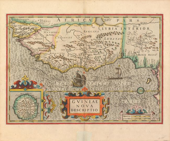
This beautifully engraved map of western Africa from Senegal, Rio Senega, to Cape Lopez on the Gulf of Guinea just below the equator. The map reflects the Portuguese exploration and settlement in the region and includes a large inset of the Island of St. Thomas. This is one of six new maps of Africa to be included in Hondius' first edition of Mercator's Atlas. It is beautifully embellished in Hondius' style with strapwork title cartouches, a Portuguese ship and native sailing boat, and fully engraved seas in a moiré style. French text and page number 637/640 on verso.
References: Norwich #316.
Condition: A
A stunning example with a strong, early impression, original color and very wide margins. Fine less a short marginal split at lower centerfold closed on recto with old paper, and well away from the image.