Subject: Philippines
Period: 1901 (dated)
Publication: Sen Doc. 280, 57th Cong., 1st Sess.
Color: Black & White
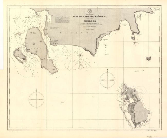
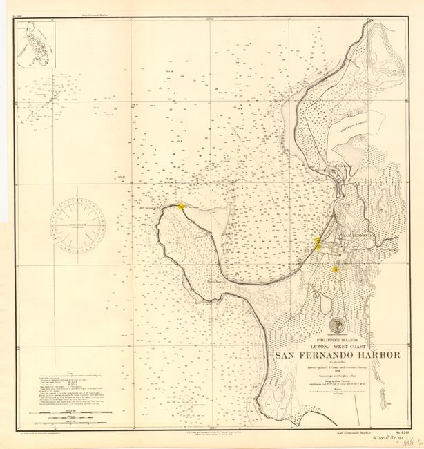
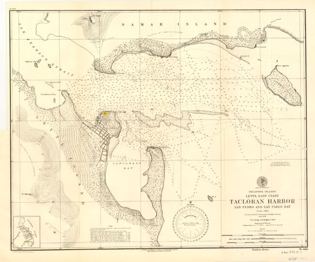
This lot has three maps from the period immediately following the Spanish American War and reflect the enormous effort to accurately survey this large area that was ceded to the United States in 1898. The first chart (18.5 x 15") covers the southern coast of Mindoro and the entire islands of Semerara and Ilin. The cartography is after the survey of Capt. Belcher, R.N., 1853, and the Spanish Government Survey of 1853. Two compass roses showing variation. Coastal areas filled with soundings or marked as hazardous. Notations include information on tides. The second chart (14.5 x 15") provides good detail and plan of the town of San Fernando. Literally hundreds of soundings fill the water. The two lighthouses are highlighted with yellow coloring. Notations give information on the tides and legend gives key to bottom type. Revised to Feb. 1902. The last chart (18.8 x 15") details the harbor with the town shown in a street grid pattern with individual buildings noted as small dots. Extends to include part of Samar Island and all of Jinamoc Island. Topography and soundings are shown in feet. Magnetic variation noted with a compass rose. The lighthouse is highlighted in yellow.
References:
Condition: A