Subject: Philippines
Period: 1748 (circa)
Publication: A Voyage Round the World…
Color: Hand Color
Size:
21.2 x 28.2 inches
53.8 x 71.6 cm
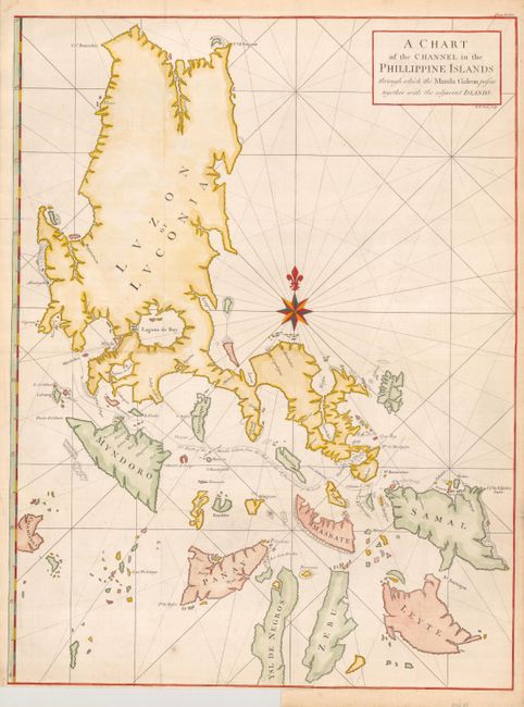
This large, graphic chart of the Philippines is from Anson's account of his circumnavigation, one of the last great buccaneering voyages. It illustrates the track of the Manila galleon route. The coasts of the islands are fairly accurately charted but there are no details inland. The chart was beautifully engraved by Richard William Seale with rhumb lines and a large compass rose.
In 1740 Anson set sail in command of a squadron sent to attack Spanish possessions and interests in South America during the War of Jenkin's Ear. The ill-equipped expedition failed to carry out its original ambitious mission and the squadron nearly perished. In June 1741 Anson collected the remaining survivors on his flagship, the Centurion, and set sail in search of one of the richly laden galleons that conducted the trade between Mexico and the Philippines. The indomitable perseverance he had shown during one of the most arduous voyages in the history of sea adventure gained him the reward of an immensely rich prize, the Nuestra Señora de Covadonga, which he encountered off Cap de Espiritu Santo on June 20, 1743.
References:
Condition: B+
Issued folded, now flattened with tissue repairs on verso to two short edge splits and a short binding trim tear just into map, otherwise fine.