Subject: South East Asia
Period: 1640 (circa)
Publication:
Color: Hand Color
Size:
19.9 x 16.3 inches
50.5 x 41.4 cm
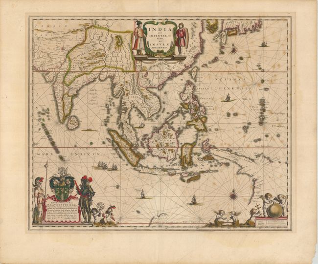
This handsome chart of Southeast Asia includes one of the most detailed images of the sphere of operations of the trading empire of the Dutch East India Company. It extends from India to New Guinea and parts of northern Australia, and north to the southern coast of Japan with a portion of Korea, which is named as an island. This map was a vast improvement over Blaeu's map of the Asian continent and was presented on Mercator's projection in the style of navigational charts. Significantly, it delineates a more correct outline of New Guinea and is the first atlas map to include the discoveries made by the Dutch in the Gulf of Carpentaria -- thus the first recorded European contacts with Australia. Richly embellished with sailing ships, compass roses and three sumptuous cartouches. The cartouche at lower left features the coat of arms and dedication to Laurens Real, Governor General of the East Indies, 1616-18. French text on verso.
References: Suarez (SEA) p. 201; MCC-60 Tooley (Australia) #226.
Condition: B
Fine impression and original color with some foxing and offsetting. Remnants of old hinges with some tape stains on verso.