Subject: Cartographic Miscellany
Period: 1822 (circa)
Publication:
Color: Black & White
Size:
23.6 x 17.5 inches
59.9 x 44.5 cm
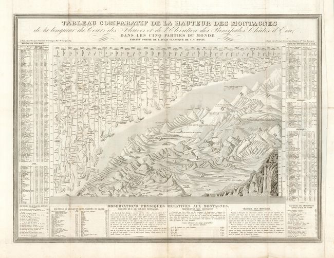
This beautifully engraved thematic chart compares the relative size of the world's mountains and rivers. Most cartographers presented some form of this design in their work, but this example is larger and more fully engraved than most others. It also includes the uncommon presentation of the relative heights of waterfalls. The rivers are aligned at upper left with the mountains and volcanoes filling the lower right with the major cities noted throughout with their elevations noted on the mountain portion. At the sides extensive tables give more detail on each feature.
References:
Condition: B+
Issued folded. Three is a little soiling on one fold and some light offsetting visible in blank upper margin.