Subject: India
Period: 1730 (published)
Publication: Claudii Ptolemaei Tabulae Geographicae Orbis Terrarum…
Color: Hand Color
Size:
18 x 13.2 inches
45.7 x 33.5 cm
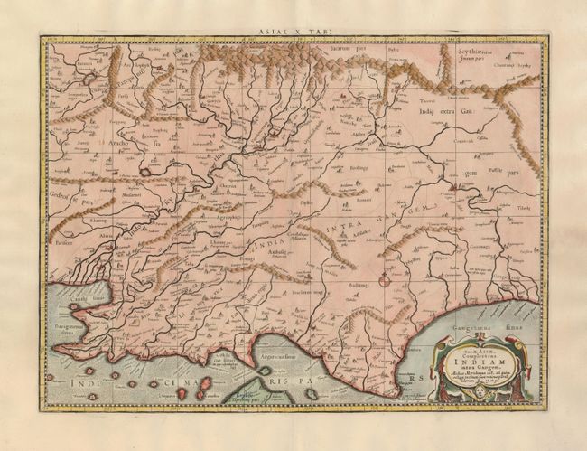
This map presents the Ptolemaic view of India. The Himalayan Mountains stretch across the top of the map and the Indus and Ganges river systems are well delineated. However, the subcontinent is considerably shortened and lacks nearly the entire southern part of India. The northern tip of Taprobana (Sri Lanka) appears at bottom. Mercator originally published this map in his 1578 edition of Ptolemy's great Geography. Although he is most renowned today for the projection he popularized and for first using the term Atlas for a collection of maps, he devoted much of his life to his Ptolemaic maps. The maps were beautifully engraved as nearly as possible to their original form and embellished with fine cartouches.
References: Mickwitz & Miekkavaara (Nordenskiold) #235-16.
Condition: B+
There is a blue ink notation "Ceylon" on Sri Lanka, else very good.