Subject: China, Korea
Period: 1757-1784 (circa)
Publication:
Color: Hand Color
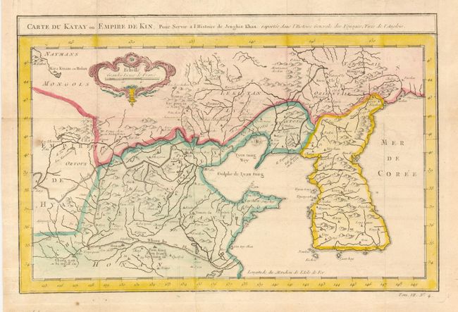
1) The first map is an uncommon issue by Jacques Nicolas Bellin published about 1757 (Paris, 12" x 7.5"). Attractive map of Korea and Northern China with a good depiction of the Great Wall. The Sea of Japan is marked Mer de Coree. The map was prepared from English sources for a history of Gengis Khan.
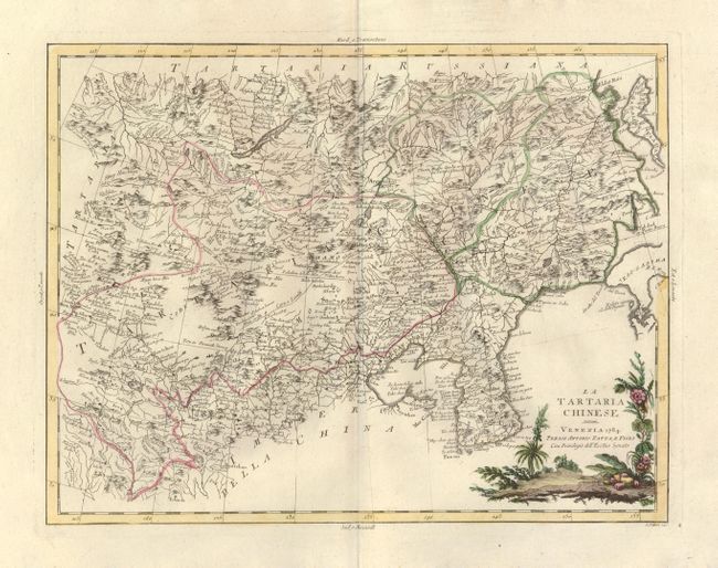
2) La Tartaria Chinese by Antonio Zatta, Venice, 1784, hand color, 15.8" x 12". This map is engraved in the fine Italian style. It details northern China, with Korea and Sakalin Island (Karafuto). Locates Peking, scores of other towns and villages, topography, watershed and delineates the Great Wall. Pictorial cartouche is in full color.
References:
Condition: A
The first was issued folded, now flattened, and with some very light offsetting and a spot at left. The latter is fine.