Subject: China, Korea & Japan
Period: 1661 (circa)
Publication: Introductionis in Universam Geographicam
Color: Hand Color
Size:
7.5 x 5.2 inches
19.1 x 13.2 cm
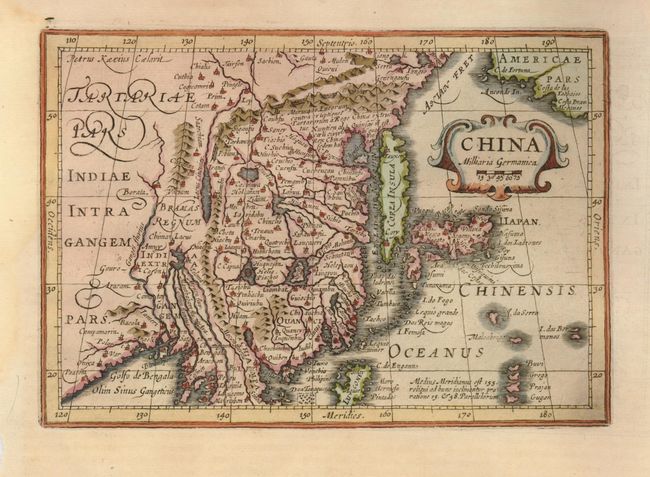
This handsome map of the region is based on the folio map by Jodocus Hondius and was designed originally for the Atlas Minor, first published in 1628. The eastern part of China (bounded in the west by the Great Wall) is dominated by several large lakes and major rivers. Korea is depicted as a strangely shaped island. The three main islands of Japan are shown below the strapwork cartouche. Americae Pars appears in the upper right corner separated from Asia by a narrow Anian Strait. Engraved by Petrus Kaerius.
References:
Condition: A
There are some light damp stains in the wide margins, not near the map.