Catalog Archive
Auction 131, Lot 770

"Carte Particuliere de la Mer Rouge &c.", Mortier, Pierre

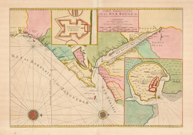
Subject: Arabia, Red Sea, East Africa

Period: 1720 (circa)

Publication: Le Neptune Francois

Color: Hand Color

Size:
29.6 x 20.6 inches
75.2 x 52.3 cm
Download High Resolution Image
(or just click on image to launch the Zoom viewer)

Dramatic sea chart covering the Red Sea and the Gulf of Aden with portions of Yemen and the east coast of Africa from modern Tanzania to Suez. There are three inset maps; a colorful map of Fort Mombassa, Mombassa Island, and a small one of the island of Socotra. Babel Mandel is prominent in the seaway between the southern Red Sea and the Gulf of Aden, and Zanzibar also appears, with many names along the coast. The map is oriented with north to the right by two spectacular compass roses.

References: Norwich #262.

Condition: A

Beautiful near flawless example on thick paper with wide margins. A little uneven toning in blank margins.

Estimate: $800 - $1,000

Unsold

Closed on 3/17/2010

Archived