Catalog Archive
Auction 131, Lot 759

"Iudaeae seu Terrae Israelis Tabula Geographica; in qua Locorum in Veteri et Novo Testamento Celebratissimorum Situs Accurate Descripti", Jansson, Jan
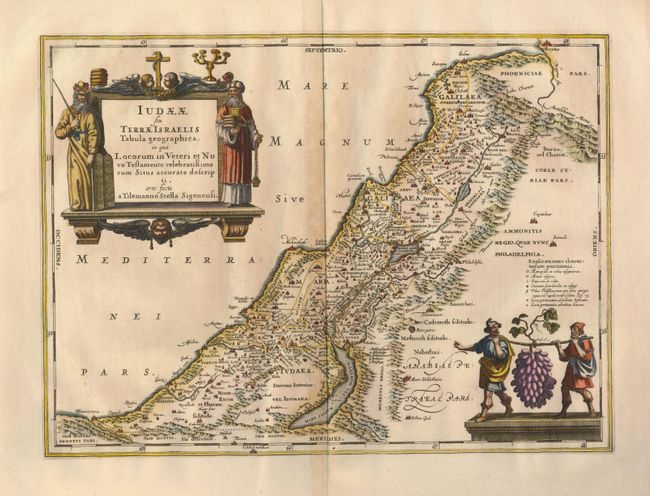
Subject: Holy Land

Period: 1652 (circa)

Publication: Accuratisima orbis antiqui deineatio

Color: Hand Color

Size:
18.8 x 13.8 inches
47.8 x 35.1 cm
Download High Resolution Image
(or just click on image to launch the Zoom viewer)

Taken from the map drawn by Tilleman Stella for Ortelius in 1584, this map describes Judae or the Land of Israel. The coastline from Berytus (Beirut) to Rhinocorura (El Arish) is delineated and all the important places in the Old and New Testament are located. The map is beautifully composed with decorative features filling opposite corners. In the Mediterranean Sea, the title cartouche is flanked by the figures of Moses and Aaron. A large vignette portraying two of Moses' spies carrying an oversize bunch of grapes that represents the bounty of the Promised Land fills the Jordanian desert.

References: Laor #373.

Condition: B+

Dark impression and wide original margins. There is minor toning along the centerfold, else very good.

Estimate: $750 - $850

Sold for: $550

Closed on 3/17/2010

Archived