Subject: Near and Middle East
Period: 1626 (dated)
Publication: A Prospect of the Most Famous Parts of the World
Color: Hand Color
Size:
20.3 x 15.5 inches
51.6 x 39.4 cm
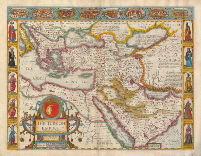
This splendid carte-de-figures map covers the region from Greece across the Middle East to include Persia and Arabia, the Black and Caspian Seas, and the Red Sea. The interior is fully engraved with mountains and deserts, numerous towns and villages with the major ones highlighed in original gauche. Included along the top are eight birds-eye views of eight important cities including Damascus, Jerusalem, Constantinople, Rhode, Alexandria, Ormus and Famagusta. Along each side are five full portraits of Greek, Egyptian, Assyrian, and Persian men on the left and their wives on the right. With numerous annotations in blank areas giving historical and geographical details. The date given is the date the plate was engraved. This edition has the imprint of Bassett and Chiswell, published circa 1676. The English text on verso provides a fascinating contemporary description of the region. Spectacular title cartouche features the crescent moon and a crown.
References: Potter (Antique Maps) pg. 119.
Condition: B+
Professionally accomplished repair to split in lower portion of centerfold with a tiny amount of loss to text in annotation at centerfold just above border.