Catalog Archive
Auction 131, Lot 58

"Descriptio Terrae Subaustralis", Hondius/Bertius
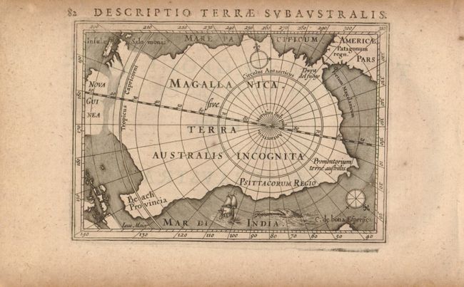
Subject: South Pole

Period: 1616 (circa)

Publication: P. Bertii Tabularum Geographicarum Contractarum…

Color: Black & White

Size:
5.3 x 3.6 inches
13.5 x 9.1 cm
Download High Resolution Image
(or just click on image to launch the Zoom viewer)

This fine miniature map is the first map to focus solely on the South Pole. It depicts the huge continent, labeled Magallanica sive Terra Australis Incognita, incorporating Terra del fuogo, Psittacorum Regio, Promontorium terrae australis, and Beach Provinca. The continent is nearly joined with New Guinea and the Salomon Islands. A small ship, sea monster and two compass roses decorate the tiny map. The title page to the atlas is on verso.

References: King, p. 83; Tooley MCC (Early Antarctica) #12.

Condition: A

Evenly toned with a couple of tiny wormholes in wide margins, well away from map.

Estimate: $500 - $600

Sold for: $650

Closed on 3/17/2010

Archived