Subject: North Pole
Period: 1606 (circa)
Publication:
Color: Hand Color
Size:
15.4 x 14.4 inches
39.1 x 36.6 cm
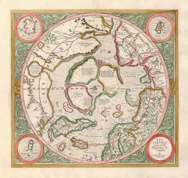
This influential map was the first separately printed map devoted to the Arctic. The hemisphere is surrounded by a floral design with four roundels in each corner. These contain the title, the Faeroe Isles, the Shetland Isles, and the mythical island of Frisland. The North Pole is shown according to legend as a large rock in a giant whirlpool and surrounded by four islands separated by rivers. One of the islands is noted as being inhabited by pygmies. The magnetic north is depicted as a separate island rock just outside the polar mass. In North America, there is a very early reference to California (California regio, sola fama Hispanis nota), curiously shown north of the El streto de Anian. The map depicts the attempts of Frobisher and Davis to locate the northern passages to Asia. This is the second state of the plate with updates in the region north of Russia including undefined coastlines to one of the islands surrounding the pole and Nova Zemla. Blank verso.
References: Burden #88; cf Kershaw #22a.
Condition: A