Catalog Archive
Auction 131, Lot 537

"Le Sund ou Detroit du Sond", Fer, Nicolas de

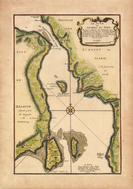
Subject: Denmark and Sweden

Period: 1705 (dated)

Publication: L'Atlas Curieux ou Le Monde…

Color: Hand Color

Size:
8.7 x 13 inches
22.1 x 33 cm
Download High Resolution Image
(or just click on image to launch the Zoom viewer)

This finely engraved map depicts the Oresund, the strait that separates the Danish island Zealand from the southern Swedish province Scania, and controls traffic between the North Sea and the Baltic Sea. Political control of Oresund has been an important issue in Danish and Swedish history with both countries erecting coastal fortresses, the most important of which are Kronborg (Danish) and Helsingborg (Swedish). The map also shows the city of Copenhagen.

References:

Condition: A

Toning in margins.

Estimate: $140 - $180

Sold for: $100

Closed on 3/17/2010

Archived