Subject: Shetland Islands, Scotland
Period: 1700 (circa)
Publication: Great-Britain’s Coasting Pilot
Color: Black & White
Size:
22 x 17.5 inches
55.9 x 44.5 cm
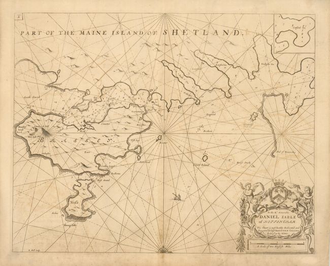
This map illustrates the Bressay Sound in the Shetland Islands and shows the islands of Bressay and Noss and across to Lerwick on Mainland. The dedication to Daniel Earle of Nottingham is enclosed in a decorative cartouche emphasizing the importance of fisheries in the region. The chart is oriented with west at top part of a compass rose at bottom. Engraved by Herman Moll.
In 1679 Greenvile Collins was appointed Hydrographer to the King by Charles II. In 1681 he was appointed by the Admiralty to make a complete survey of the coasts of Great Britain. Prior to this date the charts used by English mariners were copies of Dutch charts that had many inaccuracies and the work of John Seller that was limited in scope. The task of surveying the entire coast was formidable and took nearly a decade. The Coasting Pilot, containing 48 charts, was first published in 1693 with editions continuing until 1792.
References:
Condition: B+
Printed on double-thick paper. There is some offsetting and toning, else very good.