Subject: England
Period: 1695 (circa)
Publication: Britannia
Color: Hand Color
Size:
14.3 x 11.3 inches
36.3 x 28.7 cm
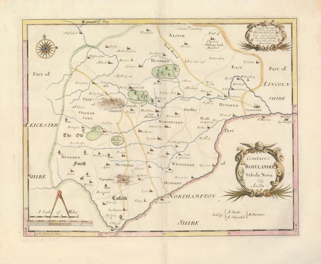
This is a close copy of Saxton and Speed's work and is one of the first to delineate roads in England. The large towns of Okeham and Uppingham feature a street grid pattern in false 3-D. It locates forests, villages, rivers and the various districts including East Hundred, Martinsley, The Old Forest of Liefeild, etc. The bordering towns of St. Martins and the Burley by Stamford in Northamptonshire and Rockingham in Leicestershire are located. Distance scale with dividers, nice compass rose and two fancy cartouches complete a pleasing composition. Sold by A. Swale and A. Churchil.
References:
Condition: A
Very fine example with just two small areas of light water stain far from the map image. Delicate hand coloring and crisp impression, with a few layout lines still visible, on fine hand laid paper with very large margins.