Catalog Archive
Auction 131, Lot 507

"A New Map of the Brittish Isles, Shewing their Antient People, Cities, and Towns of Note, in the time of the Romans", Wells, Edward
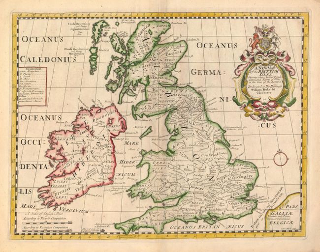
Subject: Britain

Period: 1714 (published)

Publication: A New Sett of Maps both of Antient and Present Geography

Color: Hand Color

Size:
19.2 x 14.5 inches
48.8 x 36.8 cm
Download High Resolution Image
(or just click on image to launch the Zoom viewer)

This handsome map depicts Britain during Roman times. Wells' atlas contained two maps of each region - one with its then current form and another with ancient and classical names. The large title cartouche is surmounted by the coat of arms of the Duke of Gloucester, who was Wells' student at Oxford. The map was engraved by Sutton Nicholls.

References:

Condition: A

There is some minor edge chipping, well away from the map. An old dealer's label is attached to the verso of the bottom margin.

Estimate: $350 - $425

Unsold

Closed on 3/17/2010

Archived