Catalog Archive
Auction 131, Lot 489

"Carte de l'Entendue de l'Empire Romain Ainsi que Son Etat Apres le Partage…", Chatelain, Henry Abraham

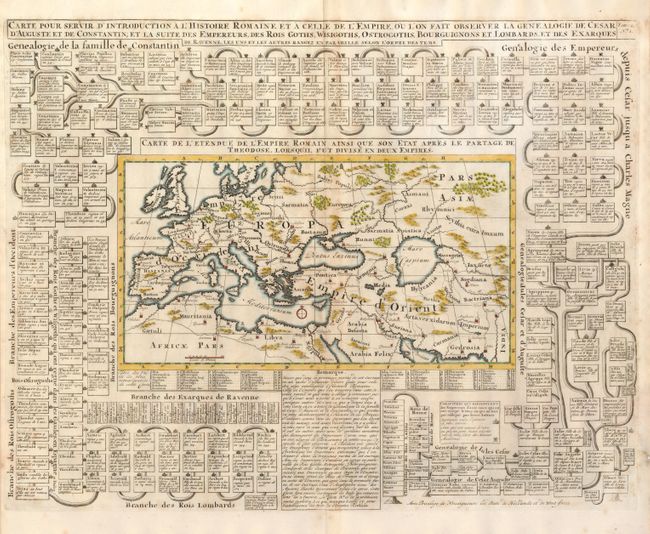
Subject: Roman Empire

Period: 1720 (circa)

Publication:

Color: Hand Color

Size:
19.7 x 15.4 inches
50 x 39.1 cm
Download High Resolution Image
(or just click on image to launch the Zoom viewer)

This great sheet has at its center a wide map of known world during Roman times. The map includes much of Scandinavia, most of northern Africa and Arabia, and reaches further east to show the Black and Caspian seas, and Central Asia and Northern India. Names the major regions, shows mountains and watershed and locates major cities. The map is surrounded by a fascinating and extensive royal genealogy to include Cesar, Charles Magne, the family of Constantinople, and more. Blank verso.

References:

Condition: B+

Very dark impression on fine sheet of hand laid paper with original margins. Light centerfold toning.

Estimate: $300 - $400

Sold for: $170

Closed on 3/17/2010

Archived