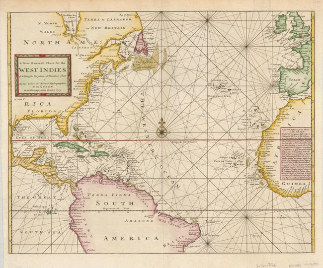
Subject: Atlantic Ocean and West Indies
Period: 1703 (circa)
Publication: Atlas Maritimus
Color: Hand Color
Size:
22.5 x 18 inches
57.2 x 45.7 cm
A crisply engraved sea chart covering most of the Atlantic Ocean but, as noted in the title, focusing on the West Indies. Place names are located along the coastal areas of North and Central America with a bit of the northern portion of South America as well as the western coast of Africa and a portion of Europe. The chart is centered on a large compass rose and the title is enclosed in a picture frame-style cartouche. A text panel in the interior of Africa explains the use of the chart. The chart was engraved by Herman Moll as noted below the cartouche. Other states are known to have been published by Seller & Price with the date 1703, and by Mount & Page in editions of the English Pilot.
References:
Condition: A
Beautiful example with some light offsetting, otherwise a fine example.