Subject: South Atlantic Ocean
Period: 1777 (published)
Publication:
Color: Black & White
Size:
13 x 12 inches
33 x 30.5 cm
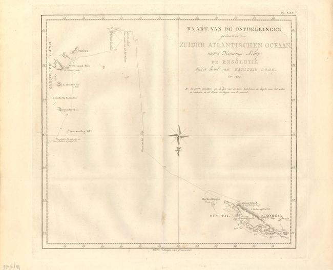
This is a Dutch edition of the map "Chart of the Discoveries Made in the South Atlantic Ocean in His Majesty's Ship Resolution under the Command of Captain Cook, in Jan. 1775." The chart details the track of H.M.S. Resolute between the South Sandwich Islands and South Georgia. Cook claimed South Georgia for the Kingdom of Great Britain, naming it the "Isle of Georgia" in honor of King George III. He named the Sandwich Islands "Sandwich Land" after the 4th Earl of Sandwich, First Lord of the Admiralty. This British overseas territory is in a remote and inhospitable portion of the southern Atlantic Ocean hundreds of miles east-south-east of Terra del Fuego. The islands are uninhabited save for a small British contingent to support the British Antarctic Survey who maintains a base at Bird Island. Argentina's claim over South Georgia contributed to the 1982 Falklands War.
References:
Condition: B+
Nice example with wide margins. A few light foxing spots near lower center.