Catalog Archive
Auction 131, Lot 453

"Plan de la Baye et Ville de Sainte Marthe et de la Coste aux Environs", Bellin, Jacques Nicolas
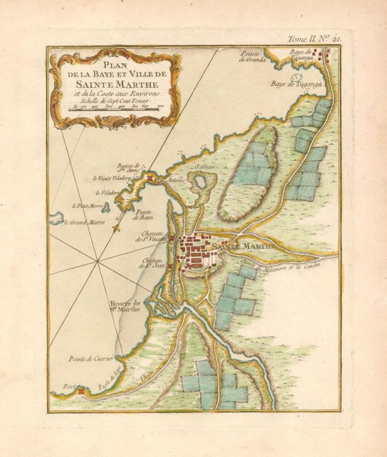
Subject: Colombia

Period: 1764 (circa)

Publication: Le Petit Atlas Maritime

Color: Hand Color

Size:
6.6 x 8.3 inches
16.8 x 21.1 cm
Download High Resolution Image
(or just click on image to launch the Zoom viewer)

This is an uncommon map of the Colombian city of Santa Marta, which at one time rivaled nearby Cartagena as the primary Spanish port in the Caribbean. The city and its natural harbor are delineated and show the four forts that protected the city.

References: Kapp (COL) #95.

Condition: A+

There is a bit of very faint toning in the blank margins, overall still fine, with original color.

Estimate: $200 - $250

Sold for: $95

Closed on 3/17/2010

Archived