Catalog Archive
Auction 131, Lot 451

"Carte de la Terre Ferme, de la Guyane dt du Pays des Amazones", Bonne/Lattre

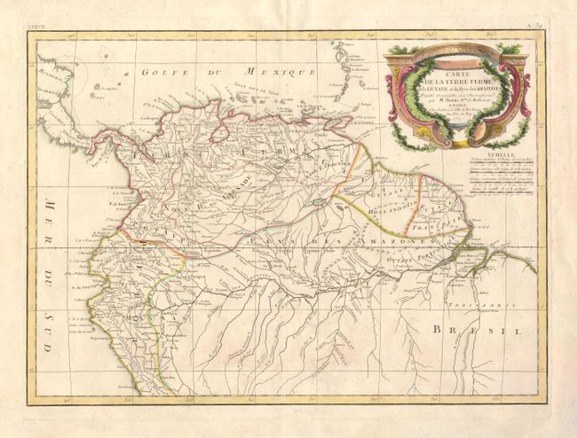
Subject: Northern South America

Period: 1771 (dated)

Publication: Atlas Moderne

Color: Hand Color

Size:
16.8 x 12 inches
42.7 x 30.5 cm
Download High Resolution Image
(or just click on image to launch the Zoom viewer)

This uncommon and finely engraved map covers the region known as Tierra Firma (Columbia and Venezuela), the Dutch, Portuguese, and French colonies of Guyana, and parts of Peru and Brazil. The region labeled Pays des Amazones shows a particularly well delineated Amazon River. One of the most interesting features on the map is Bonne's inclusion of the apocryphal Lake Parima that was first described by Walter Raleigh in the 16th century. The map is filled with information on the various tribes and locates some mines in addition to many place names.

References:

Condition: B+

Original color and just a hint of toning.

Estimate: $180 - $240

Sold for: $110

Closed on 3/17/2010

Archived