Subject: World
Period: 1747 (circa)
Publication: A Complete Atlas
Color: Hand Color
Size:
17.3 x 14.2 inches
43.9 x 36.1 cm
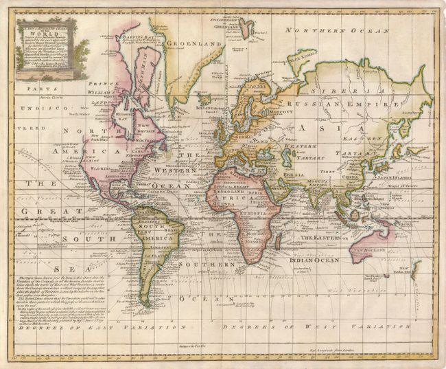
This unusual thematic chart of the world shows the magnetic variations throughout the world. Edmond Halley set out in 1700 to chart magnetic variation in order to solve one of the great problems in nautical navigation, the accurate determination of longitude. His initial work was expanded on by several British navigators in the 1740's, as represented by this map. Geographically the map shows a truncated northwestern coastline in North America and partially formed Australia and New Zealand. The map does not show interior features, instead concentrating only on coastal place names with dates of important discoveries in the oceans.
References:
Condition: B+
There is some toning and minor chipping in the blank margins and a few light areas of toning within the map. A small fold separation at top has been repaired.