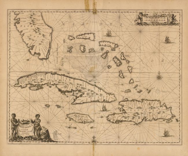
Subject: Bahamas and Greater Antilles
Period: 1650 (circa)
Publication:
Color: Black & White
Size:
20.8 x 16.2 inches
52.8 x 41.1 cm
The first state of this striking sea chart that includes the southern tip of Florida, the Bahamas, Cuba, Jamaica and Hispaniola. It is one of the first Dutch maps to feature the region on a large scale, due to the importance of the Canaal van Bahama, which was used to transport Spanish gold and silver from the New World. The cartography is based on the extremely rare Hessel Gerritsz chart of 1631, with the addition of five place names in Florida. Jansson also depicts a spurious mountain range in Florida, taken from the much earlier De Bry map. The map is embellished with a pictorial title cartouche and scale of miles, rhumb lines, galleons and two compass roses.
References: Burden #291.
Condition: C+
There is old masking tape closing fold separations on the centerfolds with resulting stains just entering the map at top and bottom. There are also several small tears in the blank margins. There is a puncture tear at the center of the map. It is presentable as is, but would benefit greatly from the attention of a professional conservator.