Subject: Bahamas
Period: 1866 (dated)
Publication:
Color: Black & White
Size:
23 x 35.5 inches
58.4 x 90.2 cm
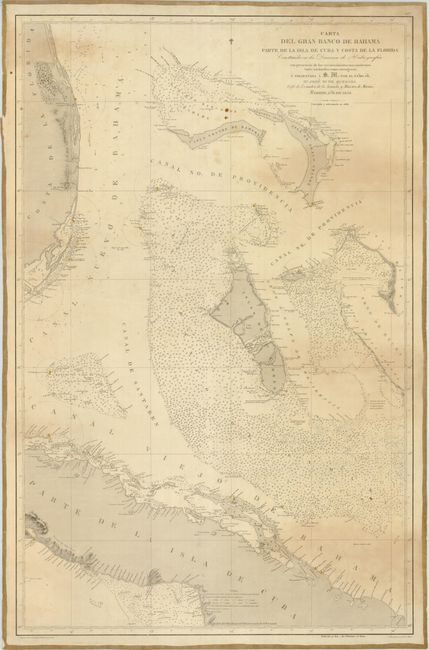
This is a scarce working Spanish sea chart that delineates the banks off the east coast of Florida from Hutchinson Island to Key Largo, the Bahamas and the mid-portion of Cuba. The chart is quite detailed and includes all the tiny islands, meticulously noted soundings, and many hand colored light-houses. In Florida, Fort Jupiter, with its important lighthouse, is located, along with the tiny town of Miami and two other lighthouses. The map was published under the auspices of the Direccion de Hydrografia by Quesado, who was the chief of cartography for the Ministry of the Navy, in 1858 and updated to 1866. The embossed stamp of the Direccion de Hydrografia, Madrid is in blank lower left corner and includes their coat-of-arms. This sturdy, working chart is backed with linen.
References:
Condition: B+
The chart has some compass circles in pencil made during navigation, still near very good and exceptional for a map of this type.