Subject: Caribbean and Northern South America
Period: 1750 (circa)
Publication:
Color: Black & White
Size:
16.6 x 14 inches
42.2 x 35.6 cm
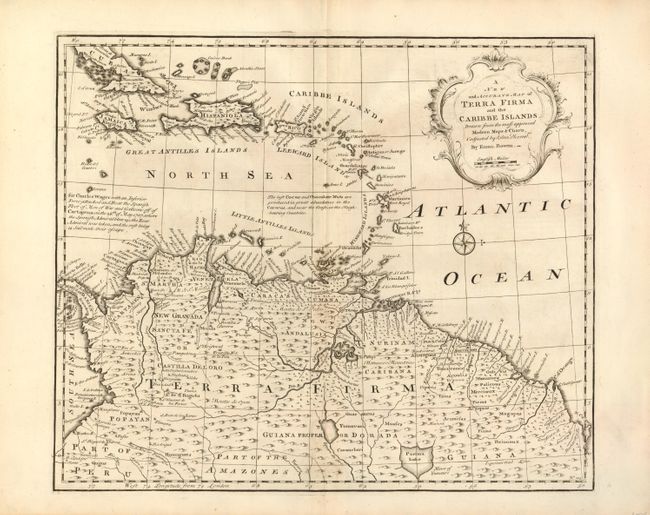
This uncommon map covers most of the Caribbean from the southern part of Cuba through the Lesser Antilles and the northern part of South America to the Amazon Basin. It illustrates the region that was contested between the various European colonial powers and is filled with information on mines, cocoa plantations, native villages, and colonial settlements. One notation describes Wager's Action where an inferior British force defeated and destroyed the Spanish treasure fleet at Cartagena. Emanuel Bowen was one of the leading English mapmakers of the 18th century. Unusually he obtained royal appointments as engraver to both the French and English Royal Courts.
References:
Condition: B+
Sharp impression and wide original margins. The centerfold is faintly toned and has been professionally reinforced with light Japanese tissue repairing 2 minor worm holes.