Subject: Colonial North America and West Indies
Period: 1740 (circa)
Publication:
Color: Hand Color
Size:
20.6 x 23 inches
52.3 x 58.4 cm
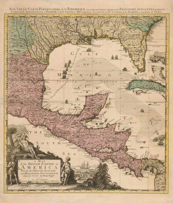
This striking map, which stands completely on its own merits with full borders and a superb cartouche, is actually part of Covens & Mortier's reduction of Henry Popple's extremely influential map of the British possessions in North America. Popple's chart was original published in 20 sheets and the Amsterdam firm of Covens and Mortier reduced it to four, more manageable sheets. This sheet is the left quadrant that covers the Gulf of Mexico and Central America. The chart is intensely detailed with names of harbors, towns & settlements, topographical features, forests and rivers. There are numerous fine sailing ships and the course of the Spanish galleons from Vera Cruz to Havana is identified. The fabulous pictorial cartouche features Native Americans and colonial merchants representing the wealth of the region. The sheet title is in the top margin, Nouvelle Carte Particuliere de l'Amerique ou sont exactement marquees les Provinces suivantes comme la Caroline Meridionale, la Floride, la Louisiane, le Mexique, le Jucatan, le Guatimala, le Darien, & une Partie de Cuba.
References: cf Cumming (SE) #231; McCorkle #741.2.
Condition: B+
Sharp impression and fine original color. There is old paper reinforcement in the left margin and a small repair on the centerfold, also at left.