Subject: Gulf of Mexico and Caribbean
Period: 1729-1803
Publication:
Color:
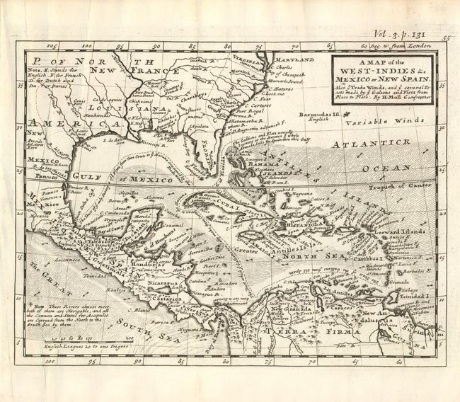
1) This small map by Herman Moll covers the southern part of the United States, eastern and southern Mexico, Central America, the Caribbean, and northern South America. Florida is shown as a stubby peninsula and the Gulf Coast cartography is still a bit confused. The huge Carolina colony includes Georgia. The map is filled with fascinating notations concerning the movements of Spain's wealthy galleons, including the route that took them into British waters off the coast of Florida and Carolina. The seas are fully engraved to illustrate the directions of trade winds. Published circa 1729 (10.4 x 8.1"), uncolored.
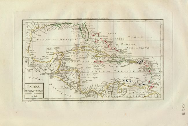
2) Tardieu's map of the region provides better detail of the navigational hazards and provides a great comparison in cartography. Dated 1803 (12.5 x 7.3"), original outline color.
References:
Condition: A
Both in nice condition with clean, crisp impressions.